Ancient orchards can reveal how communities cultivated fruit trees, organized agricultural land, and maintained long-term relationships with particular plants. Unlike annual crops, fruit trees often require several years of growth before producing substantial harvests and may remain productive for decades when properly maintained. Establishing an orchard therefore involves a different kind of investment from planting a seasonal field. It requires decisions about where trees should grow, how they should be spaced, how they will receive water, and how the harvest will be collected and used. Archaeologists can investigate these choices through the study of charcoal, pollen, seeds, landscape features, and other environmental evidence, although reconstructing the exact layout of an orchard is rarely straightforward.
The word orchard describes an area where fruit or nut trees are cultivated and managed. In antiquity, such spaces could range from small household plantings to larger agricultural plots supplying local markets or regional trade. The species grown depended on climate, soil, water availability, and cultural preferences. Some orchards may have included a limited number of trees near houses, while others occupied larger areas integrated with fields, pastures, or irrigation systems. The presence of fruit remains at a settlement does not automatically indicate that an orchard existed nearby, since fruit could have been collected from wild trees or transported from another location.
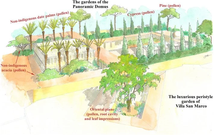
Pollen profiles can provide important evidence about the vegetation surrounding an archaeological site. Pollen is produced by flowering plants and may become preserved in lake sediments, peat, soils, and other deposits under suitable conditions. By examining pollen from different depths, researchers can reconstruct changes in vegetation through time. An increase in pollen from particular tree groups may indicate that those plants became more common in the landscape. However, pollen dispersal varies between species, and some trees produce pollen that travels long distances. A pollen record may therefore reflect regional vegetation rather than a cultivated orchard immediately beside the sampling location.
The interpretation becomes more complex when researchers attempt to distinguish cultivated trees from wild vegetation. Some fruit trees belong to groups that also occur naturally in surrounding landscapes, and pollen from related species may be difficult to separate under a microscope. Even when a pollen grain can be identified to a particular plant group, it may not reveal whether the tree was planted, protected, grafted, or simply growing without deliberate management. Evidence of cultivation must therefore be supported by other indicators, including fruit remains, tree planting patterns, agricultural structures, and changes in the surrounding environment.
Charcoal provides another important source of information. When wood is burned, its cellular structure can sometimes survive in the resulting charcoal, allowing specialists to identify the type of tree or shrub from which it came. Charcoal found in hearths, kilns, or other archaeological contexts may reveal which fuels people selected and which trees were available or valued. If charcoal from fruit-bearing trees occurs repeatedly at a settlement, researchers may investigate whether those trees were cultivated locally. Yet charcoal alone cannot establish the existence of an orchard. Wood may have been collected from wild trees, imported as fuel, or reused for construction and other purposes before being burned.
The location and context of charcoal samples are crucial. Charcoal from a domestic hearth may reflect everyday fuel selection, while charcoal from a large industrial installation could represent a different demand for wood. A single fragment may have come from a branch rather than a mature tree, and some wood species were preferred because they burned well rather than because their fruit was harvested. Researchers compare charcoal assemblages across several contexts to determine whether a pattern is consistent with repeated use of particular tree species. The results can become more informative when combined with pollen and other botanical remains.
Seeds and fruit stones may provide more direct evidence of fruit use. Pips, pits, shells, and other remains can sometimes be identified to species or closely related groups. Large quantities of fruit remains may indicate consumption, processing, storage, or disposal, while concentrations near buildings could suggest that certain activities occurred in a particular area. However, fruit remains may have been brought from elsewhere, and their presence does not necessarily prove that the plants grew locally. Researchers need to consider whether the species could have been transported, traded, or collected from wild populations.
The reconstruction of orchard layout depends heavily on spatial evidence. Archaeologists may identify planting pits, terraces, irrigation channels, boundary walls, or regularly spaced depressions that could represent former tree locations. A repeated pattern of pits may suggest deliberate planting, especially if the features share similar dimensions and alignments. Nevertheless, natural processes can create depressions, and planting features may be difficult to distinguish from post-holes or other excavated structures. The spacing of trees may also change over time as older plants die, new ones are introduced, or cultivation practices evolve.
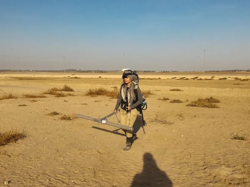
Remote sensing and landscape survey can help locate possible orchard remains. Aerial photographs, elevation models, and geophysical methods may reveal terraces, boundary systems, and subtle patterns in the ground surface. In some landscapes, former agricultural plots survive as earthworks even after the trees themselves have disappeared. Soil chemistry may also reveal differences between cultivated and uncultivated areas, although such patterns can be influenced by many factors. Archaeologists combine these observations with botanical evidence to assess whether the landscape is consistent with deliberate fruit cultivation.
Water management may have been important in maintaining an orchard, particularly in regions with dry summers or irregular rainfall. Terraces and channels could have helped retain moisture, direct water toward trees, or reduce soil erosion. The presence of irrigation infrastructure does not automatically establish that fruit trees were grown there, since the same systems could support other crops. However, when water-management features occur alongside fruit remains, suitable pollen, and evidence of planting, they may strengthen the interpretation of a cultivated orchard.
Ancient orchards could also have formed part of a mixed agricultural system. Fruit trees may have been planted along field boundaries, around houses, or within areas used for grazing animals. Some communities might have allowed livestock to move among trees during particular seasons, while others protected their orchards from animals that could damage young plants. Such arrangements would influence the spatial organization of the landscape and the way resources were shared between different activities. The archaeological evidence may preserve traces of these systems through fences, enclosures, field boundaries, and changes in vegetation.
The chronology of orchard development is particularly important because fruit cultivation can persist across generations. A tree may have been planted during one period and continued producing fruit long after the original household or settlement changed. Charcoal from an orchard tree may date its burning rather than its planting, while pollen profiles often provide broad chronological sequences rather than precise dates for individual trees. Radiocarbon dating of suitable seeds, fruit stones, or other organic material may help establish the period when particular plants were present, although the relationship between the sample and the orchard itself must be demonstrated.
Changes in pollen and charcoal profiles can also reveal the abandonment or transformation of cultivated land. A decline in pollen from particular tree groups may indicate that orchards became less extensive, but it could also reflect changing regional vegetation or differences in pollen preservation. An increase in charcoal from other plant types might reflect new fuel preferences, woodland clearance, or a change in the local economy. Researchers must consider whether these changes occurred gradually or alongside broader environmental events such as drought, flooding, or shifts in land use.
The study of ancient orchards brings together environmental archaeology, plant identification, landscape reconstruction, and agricultural history. Pollen profiles reveal changes in vegetation, charcoal provides evidence about the use of wood, and fruit remains can show which plants people consumed or processed. When these sources are combined with planting features, irrigation systems, and spatial patterns, archaeologists can investigate whether a landscape contained deliberately managed orchards and how those orchards changed over time. Although the exact position of every tree may remain unknown, the combined evidence can reveal how communities invested in long-term cultivation and shaped their surroundings to support fruit production.