Introduction
Crete's olive groves are among the most recognizable agricultural landscapes of the Mediterranean. Olive cultivation has shaped the island's economy, cuisine, ecology, and cultural identity for thousands of years.
Today, agriculture is increasingly influenced by technologies such as drones, satellite imagery, artificial intelligence, machine learning, and precision irrigation. These tools can help farmers identify plant stress, estimate crop conditions, map terrain, and improve the timing of agricultural interventions.
The title Forgotten AI-Powered Olive Drones Over Crete's Terraces suggests a hidden or overlooked technological transformation taking place above traditional olive landscapes. While AI-assisted agricultural drones are technically plausible and increasingly used in precision agriculture, claims about specific forgotten systems in Crete should be verified rather than assumed.
Traditional Olive Cultivation
Olive farming in Crete has deep historical roots. Archaeological evidence demonstrates the importance of olives and olive oil in ancient Aegean economies.
The modern landscape contains groves that may include trees of varying ages, traditional terraces, stone walls, tracks, irrigation infrastructure, and processing facilities.
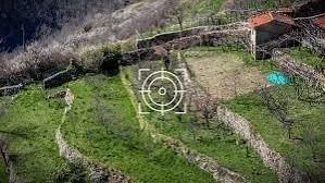
Terracing is particularly important in hilly and mountainous areas. Stone walls help create cultivable surfaces on slopes and can reduce soil erosion.
These landscapes are therefore not simply agricultural fields. They are long-term cultural landscapes shaped by generations of human labor.
What Agricultural Drones Can Do
Drones provide farmers with a perspective that is difficult to obtain from ground level.
Equipped with cameras and sensors, drones can collect high-resolution images of fields.
Standard RGB cameras can reveal visible differences in plant condition. Multispectral or thermal sensors can provide additional information about vegetation vigor, temperature, and water stress.
The resulting data can be processed using specialized software or artificial-intelligence systems.
AI algorithms can identify patterns that might be difficult to detect manually across thousands of trees.
AI and Olive-Tree Health
One potential application is detecting signs of plant stress.
Healthy vegetation reflects and absorbs different wavelengths of light compared with stressed plants.
Machine-learning models can be trained to identify patterns associated with drought, nutrient deficiencies, disease, or pest activity.
However, an AI system does not automatically know what caused a particular visual anomaly.
A yellowing tree might be affected by water stress, disease, soil conditions, age, or physical damage.
Field inspection remains important.
AI should therefore be considered a decision-support tool rather than an infallible agricultural authority.
Monitoring Water Stress
Water management is increasingly important in Mediterranean agriculture because climate variability can create periods of severe drought.
Drones equipped with thermal or multispectral sensors can potentially identify differences in plant temperature and vegetation condition.
This information can help farmers investigate areas where irrigation may be inadequate.
In terraced landscapes, water distribution can be uneven because of slope, soil depth, and drainage.
Precision mapping could help identify these differences.
Detecting Pests and Disease
Olive trees can be affected by pests and diseases that reduce yields and damage fruit.
Early detection can be valuable because intervention may be more effective before a problem spreads widely.
Drone imagery can help identify unusual patterns, while AI systems can classify images based on previously trained datasets.
The quality of the result depends heavily on the quality and diversity of the training data.
A model trained on one variety of olive tree under one climate may perform poorly when applied to another region.
Mapping Ancient Terraces
Drone technology has applications beyond crop monitoring.
High-resolution aerial imagery can document historic terraces, stone walls, tracks, abandoned fields, and other landscape features.
Three-dimensional mapping can create detailed digital models of terrain.
These models can help researchers understand how agricultural landscapes were constructed and maintained.
This is particularly interesting in Crete because traditional agriculture and archaeological heritage often overlap.
The Phrase “Forgotten”
A technology can be “forgotten” in several ways.
A pilot agricultural project may end after funding expires. A farmer may stop using a system because equipment becomes obsolete. A research program may produce valuable data that is not widely adopted.
Digital agriculture evolves rapidly, and hardware can become outdated within a few years.
This creates a challenge for long-term rural technology projects.
The physical olive trees may survive for centuries while the digital tools used to manage them change rapidly.
Barriers to Adoption
Drone-based agriculture is not automatically economical for every farmer.
Equipment costs, software subscriptions, pilot certification, maintenance, data processing, and technical training can create barriers.
Small farms may find it more efficient to hire specialized agricultural service providers rather than purchase their own drones.
Connectivity can also be an issue in mountainous terrain.
The Future of AI in Cretan Agriculture
Future systems could combine drone imagery, satellite data, weather forecasts, soil sensors, irrigation systems, and historical yield records.
An AI platform might analyze these datasets together and identify areas requiring attention.
Such systems could help farmers use water and agricultural inputs more efficiently.
But technology should complement agricultural knowledge rather than replace it.
Farmers possess local knowledge about soil, tree age, microclimates, pests, and seasonal patterns that may not be represented in a digital dataset.
Conclusion
AI-powered drones could become an important part of modern olive cultivation in Crete, particularly for monitoring plant health, water stress, pests, and complex terraced landscapes.
The specific idea of forgotten drone systems should be treated cautiously unless supported by documented projects.
The larger transformation is nevertheless significant. Ancient olive landscapes are increasingly being observed through satellites, drones, sensors, and artificial intelligence, creating a striking combination of Mediterranean agricultural heritage and twenty-first-century technology.