Introduction
Thasos, an island in the northern Aegean, was an important center of ancient Greek settlement, trade, and resource extraction.
Its strategic position and natural resources supported a long history of political and economic activity.
The island's mountainous landscape includes elevated locations suitable for defensive installations and observation.
The possibility of Hellenistic fortifications on a Thasos acroterion raises questions about military architecture, coastal defense, and the control of strategic high ground.
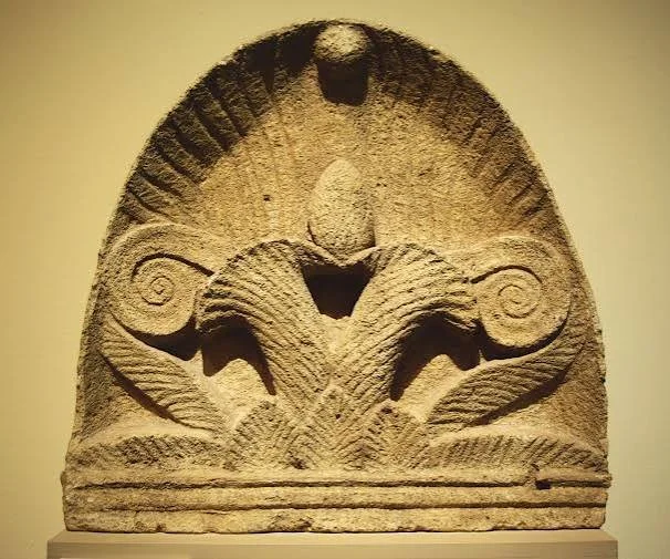
The term acroterion requires clarification. In classical architecture, it usually refers to a decorative element placed at the apex or corners of a building's pediment. If the intended meaning is a rocky summit or elevated promontory, the Greek term akroterion may be used geographically in that sense. A specific fortification complex must still be established through archaeological evidence.
Thasos in the Hellenistic Period
Thasos developed as an important island community with connections to the northern Aegean and the Thracian mainland.
Its economy benefited from agriculture, maritime trade, and valuable natural resources, including marble and mineral deposits.
During the Hellenistic period, the island experienced the wider political transformations affecting the eastern Mediterranean after the campaigns of Alexander the Great.
Control of ports, roads, and elevated positions remained important to local security.
The Strategic Importance of High Ground
Elevated locations offered several defensive advantages.
They provided views over surrounding coastlines and inland routes.
A fortified summit could serve as an observation point, a refuge, or a military position protecting nearby settlements.
The effectiveness of a fortification depended on its relationship with the terrain.
Steep slopes could reduce the number of approaches an attacker could use, while ridges and natural rock formations could be incorporated into defensive walls.
Hellenistic Military Architecture
Hellenistic fortifications became increasingly sophisticated.
Builders used carefully cut stone blocks, defensive towers, gates, curtain walls, and other structures to protect important settlements.
Some fortifications were designed to withstand siege engines and organized military assaults.
Others were smaller installations intended to control roads, harbors, and strategic passes.
The architectural design reflected the military technologies and political conditions of the period.
Walls and Towers
A Hellenistic defensive wall could consist of substantial stone foundations with carefully arranged masonry above.
Towers projected from the wall line to provide additional defensive positions.
Their placement allowed defenders to observe approaching forces and protect vulnerable sections.
Gateways were especially important because they created controlled points of access.
Some gates were designed with angled approaches or additional defensive arrangements to make direct attacks more difficult.
The Landscape of Thasos
Thasos contains a varied landscape of mountains, valleys, forests, and coastal plains.
Its elevated areas offered natural defensive advantages.
Fortifications could protect mining districts, settlements, agricultural land, and maritime approaches.
However, a defensive wall found on a summit cannot automatically be dated to the Hellenistic period.
Its construction technique and associated finds must be examined carefully.
Military and Economic Functions
Fortifications were not always built exclusively for warfare.
A fortified position might also protect valuable economic resources.
Mining districts, transportation routes, and agricultural settlements could require security.
Military installations could also support administrative control over a territory.
The relationship between a fortification and nearby economic activity is therefore important for understanding its purpose.
Dating a Fortification
Archaeologists use several methods to establish the date of defensive structures.
Masonry style can provide preliminary chronological information.
Associated pottery, coins, and other objects may help establish a date range.
Stratigraphic relationships can reveal whether a wall belongs to an original construction phase or a later rebuilding.
A fortification may also have been repaired or modified over several centuries.
Archaeological Survey and Digital Mapping
Modern survey techniques can help researchers understand defensive landscapes.
Aerial photography and satellite imagery may reveal wall lines and other features hidden by vegetation.
Photogrammetry can document surviving masonry.
Geographic information systems allow researchers to analyze visibility, movement routes, and the relationship between fortifications and nearby settlements.
These methods can also help identify sections requiring further excavation.
Conservation
Ancient defensive walls are vulnerable to erosion, vegetation, stone removal, and modern development.
Their exposed positions often increase the effects of wind and weather.
Conservation should prioritize stabilizing original masonry and documenting structural damage.
Reconstruction should be limited to areas where archaeological evidence supports the proposed arrangement.
Conclusion
Hellenistic fortifications on an elevated position of Thasos would provide important evidence for the island's defensive organization and political history.
Their study could reveal how communities used natural terrain to protect settlements, resources, and maritime routes during a period of changing regional power.
However, the specific identification of Hellenistic fortifications on a Thasos acroterion requires precise geographical identification and archaeological dating. The distinction between a natural summit, an architectural acroterion, and a fortified promontory is essential to interpreting the title accurately.