Introduction
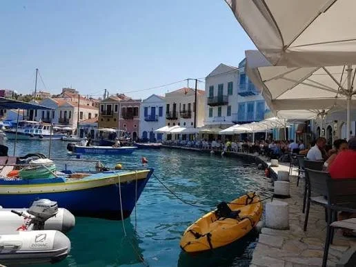
Kastellorizo, also known as Megisti, is a small Greek island located close to the southwestern coast of Anatolia. Its position made it an important point within eastern Mediterranean maritime networks, particularly during periods when shipping, fishing, and regional commerce connected the islands with nearby mainland ports.
The island's coves and sheltered coastal areas provide an interesting setting for investigating historical maritime infrastructure. Among the structures associated with boat construction and maintenance are slipways, inclined surfaces that allow vessels to be moved between land and water.
The possibility of Ottoman-period slipways in Kastellorizo's coves raises questions about local shipbuilding, fishing economies, and coastal defense. However, identifying a particular structure as Ottoman requires architectural and historical evidence.
Kastellorizo's Maritime Geography
Kastellorizo lies only a short distance from the Anatolian coast. Its location gave it access to maritime routes connecting the eastern Mediterranean with the Aegean.
The island's coastline contains natural coves that provide varying degrees of shelter from wind and waves. These spaces could support small boats, fishing activities, loading operations, and temporary anchorage.
The island's limited land area also encouraged close interaction between settlement and shoreline. Maritime activities were not separate from daily life but formed an essential part of the community's economic environment.
Ottoman Rule in the Eastern Mediterranean
The Ottoman Empire controlled much of the eastern Mediterranean for several centuries, incorporating numerous islands and coastal communities into its administrative and commercial networks.
The degree of Ottoman control varied by location and period. Local communities often retained established economic practices while operating within wider imperial systems.
Maritime transport was important for communication, taxation, trade, and military movement. Smaller islands could contribute through fishing, provisioning, coastal shipping, and the maintenance of vessels.
Kastellorizo's proximity to Anatolia made its maritime relationships particularly significant.
What Is a Slipway?
A slipway is an inclined structure that allows a boat to be launched into or removed from the water.
Traditional slipways could consist of a prepared stone or timber surface extending from the shoreline toward deeper water. Depending on their design, they might incorporate grooves, rails, rollers, or other features to reduce friction.
Small vessels could be hauled onto shore for cleaning, repairs, storage, or protection from storms.
A slipway differs from a harbor wall or landing platform because its principal purpose is to facilitate the movement of a vessel between water and land.
Identifying Ottoman-Era Structures
Dating a slipway requires examining its construction materials, architectural features, and relationship with other coastal buildings.
Stonework alone cannot establish an Ottoman date because similar techniques were used over many centuries. More reliable evidence may include inscriptions, associated buildings, archival references, and securely dated deposits.
Researchers may also examine historical maps and photographs to determine whether a coastal structure existed during a particular period.
A structure that was built during Ottoman rule may have been repaired or substantially modified in later periods, so its construction history must be assessed in stages.
Boatbuilding and Repair
Small maritime communities depended on the ability to maintain their vessels. Wooden boats required regular inspection, cleaning, caulking, and replacement of damaged components.
A slipway made these tasks easier by allowing a vessel to be moved into a stable working position.
Local boatbuilders needed knowledge of timber selection, hull construction, waterproofing, and the effects of weather and seawater.
The presence of a slipway could therefore indicate an organized maritime working area, although it would not necessarily prove that large-scale shipbuilding took place there.
Fishing and Coastal Commerce
Fishing was an important economic activity throughout the eastern Mediterranean. Small boats required sheltered locations where they could be launched and maintained.
Coastal commerce also depended on vessels capable of carrying goods between nearby settlements. Such boats transported food, household supplies, agricultural products, and other commodities.
Kastellorizo's position near Anatolia would have supported frequent contact across the narrow stretch of water separating the island from the mainland.
Slipways could have served several purposes within this environment, supporting both household fishing and broader commercial activity.
Archaeological Investigation of the Coves
A systematic survey of Kastellorizo's coves could identify possible slipways through their physical characteristics and relationship with nearby structures.
Researchers would examine the slope, surface preparation, drainage, and any evidence of rails or hauling systems.
Underwater surveys could determine whether the structure continued beneath the present shoreline or connected to an earlier landing area.
Historical photographs, maritime records, and local oral histories may provide additional context, although they should be assessed alongside physical evidence.
Preservation of Maritime Heritage
Coastal infrastructure is vulnerable to wave action, salt crystallization, erosion, and modern construction.
Slipways may be reused, covered, or modified as harbor facilities change. Their original dimensions and functions can become difficult to recognize.
Documentation through photography, measured drawings, and three-dimensional recording can preserve valuable information.
Conservation should also consider the relationship between a slipway and its surrounding cove, because the broader coastal setting helps explain why the structure was built in that location.
Conclusion
Ottoman-period slipways in Kastellorizo's coves would offer an important perspective on the island's maritime economy and its relationship with the eastern Mediterranean.
Such structures could reveal how local communities maintained fishing boats, supported coastal commerce, and adapted sheltered shorelines to practical needs. Nevertheless, the specific attribution of surviving slipways to the Ottoman period requires secure dating and historical documentation.
The wider study of these coastal installations demonstrates how relatively modest structures can preserve evidence of centuries of everyday maritime activity.