Introduction
The Evros, also known as the Maritsa, flows through southeastern Europe before reaching the Aegean Sea, where it forms an extensive delta on the border between Greece and Turkey. The delta is an important wetland landscape, shaped by river sediment, coastal processes, seasonal flooding, and the interaction of freshwater with seawater.
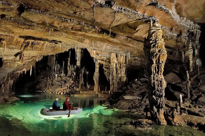
A river delta can conceal a complicated network of channels, buried sediments, groundwater pathways, and wetland habitats. These features are sometimes described in popular writing as underground rivers or hidden caverns. Yet a distinction is essential: an underground river flowing through a limestone cave is a different geological feature from groundwater moving through sand, gravel, and sediment beneath a delta.
The Evros Delta is best understood through its documented river, wetland, and coastal systems. The existence of a particular network of subterranean rivers carving caverns beneath the delta would require specific geological evidence.
How Underground Rivers Form
Underground rivers commonly develop in soluble rocks such as limestone. Rainwater absorbs carbon dioxide from the atmosphere and soil, forming a weakly acidic solution. Over long periods, this water dissolves parts of the limestone, enlarging cracks and creating passages, shafts, and chambers.
This process is known as karstification. In mature karst landscapes, water may disappear into sinkholes, flow through underground conduits, and emerge at springs some distance away. Some cave systems carry substantial water volumes, particularly during periods of heavy rainfall.
Not all underground water travels through large tunnels. In many geological environments, water moves through tiny pores between sediment grains or through fractures in rock. Such groundwater flow can be important for ecosystems and water supplies without forming accessible caverns.
The geology beneath a river delta often differs from that of a classic limestone cave system. Deltas commonly contain layers of sand, silt, clay, and gravel deposited by rivers and coastal processes. Water may move through permeable layers, while clay-rich sediments restrict its movement.
The Evros Delta as a Dynamic Landscape
The Evros Delta has developed through the repeated movement of water and sediment. Rivers transport material from inland regions and deposit it as they enter lower-energy coastal waters. Waves and currents then redistribute some of that sediment, while changes in water level and river discharge reshape channels and wetlands.
The delta's habitats include lagoons, marshes, reed beds, shallow lakes, and coastal areas. These environments provide feeding and breeding grounds for numerous species, particularly birds that depend on wetlands during migration and seasonal changes.
Beneath the visible landscape, groundwater can interact with surface water. Freshwater may seep through sediments, and the movement of water can influence soil moisture, vegetation, and the chemical composition of wetlands. The relationship between groundwater and surface channels can be complex and can vary with season, rainfall, river discharge, and coastal water levels.
However, these processes do not establish the presence of large caverns beneath the delta. Such a claim would require geological mapping, borehole information, geophysical surveys, or direct exploration of a confirmed cave system.
Why Hidden Waterways Matter
Groundwater systems can influence wetlands even when they remain invisible. They may supply water during dry periods, transport dissolved minerals, and affect the distribution of plant communities. In coastal areas, groundwater also interacts with salinity, which can determine whether freshwater or salt-tolerant species dominate particular habitats.
Human activity can alter these systems. Agricultural drainage, groundwater extraction, dams, pollution, and changes in river sediment supply may affect water levels and wetland ecology. Climate change adds further uncertainty by influencing rainfall patterns, evaporation, drought frequency, and coastal conditions.
Understanding the delta's hydrology therefore has practical importance. It helps researchers evaluate wetland conservation, water availability, and the long-term stability of habitats.
Researching Subterranean Features Responsibly
A scientific investigation of possible underground channels would begin with existing geological maps and hydrological records. Researchers could examine borehole logs, groundwater levels, sediment composition, and geophysical measurements. If a suspected cavern were identified, specialists would need to assess its structure and safety before entering it.
The delta's ecological sensitivity must also be considered. Unnecessary drilling or cave exploration can disturb habitats and alter groundwater movement. Field research should follow environmental regulations and involve appropriate geological and ecological expertise.
Conclusion
The Evros Delta is a landscape in which rivers, groundwater, sediments, and coastal processes interact continuously. These processes can create hidden pathways beneath the surface, but the phrase “subterranean rivers carving Evros Delta caverns” should not be treated as a confirmed description of a known cave network.
The more firmly established story is already remarkable: a major river has built a complex wetland system that supports wildlife and responds to changes across an extensive watershed. Studying its hidden water movement offers valuable insight into how deltas function and why their conservation matters.