The placement of prehistoric settlements was influenced by a combination of environmental opportunities, practical needs, and social decisions. Large rivers and lakes often receive considerable attention in archaeological studies because they provided transportation routes, water, food, and access to fertile land. Smaller streams, however, could be just as important in shaping where people chose to live. A minor stream might supply drinking water, support small-scale cultivation, attract animals, or provide a convenient route through a landscape. Although these waterways may appear insignificant on modern maps, their importance to past communities could have been substantial.
Water was essential to everyday life. People needed reliable sources for drinking, cooking, cleaning, and processing materials, while livestock required regular access to water. A settlement near a small stream could reduce the time and effort required to meet these needs. Streams could also provide water for growing crops, especially in environments where rainfall was unpredictable or seasonal. The importance of a particular water source depended on its reliability, accessibility, water quality, and relationship to other resources. A stream that flowed throughout the year would have offered different advantages from one that dried up during the hottest months.
Minor streams also influenced the availability of food. Their banks and surrounding wetlands could support fish, amphibians, birds, and other animals, depending on the ecological conditions. Vegetation near the water might provide edible plants, construction materials, fuel, and fodder for domesticated animals. Streams could create small areas of fertile soil through the deposition of sediments, potentially supporting cultivation or gardens. Yet these benefits were not universal. Flooding, erosion, poor water quality, or seasonal shortages could make some streamside locations less attractive, particularly if a settlement lacked the means to manage these risks.
The surrounding terrain played an important role in determining how people used a stream. A gently sloping valley might provide access to water while offering nearby land suitable for cultivation. A narrow gorge could provide shelter or a natural route through difficult terrain but might limit the space available for houses and fields. Settlements placed on slightly elevated ground near a stream could balance access to water with protection from flooding. Archaeologists can investigate these choices by examining the relationship between settlement remains, former stream channels, slopes, soil types, and evidence of past flooding.
Modern streams do not always follow the same routes as their prehistoric counterparts. Channels can shift through erosion and sediment deposition, while changes in climate and vegetation may alter the amount of water flowing through a landscape. Human activities, including agriculture, drainage, dams, and urban development, can further modify waterways. As a result, a prehistoric settlement that appears distant from water today may once have stood beside a reliable stream. Reconstructing the ancient landscape is therefore an important part of understanding settlement placement.
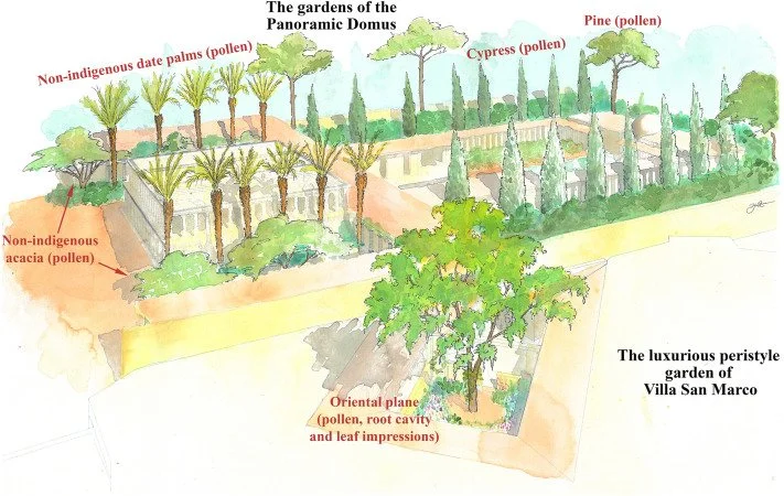
Geoarchaeology can help researchers identify former stream channels and reconstruct how they changed over time. Sediment cores may reveal layers deposited by flowing water, while grain size and sediment composition can provide clues about the speed and energy of past currents. Organic material preserved in these deposits may help establish when a channel was active or when flooding occurred. Pollen and other environmental indicators can reveal changes in vegetation around the watercourse. When these records are combined with archaeological dating, researchers can determine whether a stream was present when a settlement was occupied.
The location of houses and activity areas relative to the stream can also reveal how residents organized their daily lives. Buildings positioned close to the water may have been associated with washing, food preparation, or craft activities that required a regular supply of water. Other structures may have been placed farther away to reduce exposure to damp conditions or flooding. Paths leading toward the stream could indicate repeated movement between houses and the water's edge. However, proximity alone does not establish the function of a building, and archaeologists must consider artifacts, floor deposits, and other evidence before assigning particular activities to specific locations.
Small waterways could also influence communication and movement between settlements. A stream valley may provide a relatively easy route through hills or forested terrain, connecting communities with fields, grazing areas, neighboring villages, or larger rivers. Even a minor watercourse may guide movement because its banks offer open ground or because the surrounding landscape funnels travelers along a particular path. At the same time, streams can create obstacles, especially during flooding. Bridges, stepping stones, fords, and paths crossing the water may leave archaeological traces, although such features are often difficult to preserve and identify.
The relationship between streams and agriculture deserves particular attention. Small channels could supply water for household gardens, irrigated plots, or livestock, while nearby soils might support crops that required more moisture than the surrounding land could provide. Archaeologists may investigate these possibilities through botanical remains, pollen profiles, phytoliths, and evidence of ancient field boundaries. The presence of cultivated plants near a stream does not necessarily mean that irrigation was practiced, since rainfall and soil moisture may have been sufficient. Evidence of channels, water-control structures, or repeated modifications to the stream would strengthen an interpretation involving deliberate water management.
Minor streams may also have influenced settlement choices through their seasonal patterns. Communities that moved between different locations during the year could have selected streamside camps when water and vegetation were abundant. Farmers and herders might have used the same area differently depending on rainfall, crop cycles, and livestock requirements. Repeated occupation near a water source could reflect a permanent settlement, a seasonal camp, or a place visited for particular activities. Distinguishing between these possibilities requires attention to the density and character of the archaeological remains, the construction of buildings, and the evidence for repeated use.
Environmental risk must be considered alongside the advantages of water access. Small streams can flood rapidly during heavy rainfall, and their channels may change unexpectedly. Settlements placed too close to the bank could suffer damage to buildings, storage facilities, and cultivated land. The presence of flood deposits within occupation layers may indicate that residents experienced such events, although natural flooding could also have occurred after a settlement was abandoned. Archaeologists can investigate whether communities adapted to these risks by building on raised ground, reinforcing banks, or relocating structures over time.
The study of minor streams helps broaden our understanding of prehistoric settlement beyond the most visible rivers and lakes. These smaller waterways could support daily survival, influence the organization of houses and fields, and shape routes through the landscape. Their significance varied according to climate, terrain, water reliability, and the needs of the communities that lived nearby. By combining archaeological mapping with sediment analysis, environmental reconstruction, and evidence of everyday activities, researchers can better understand why apparently modest streams sometimes played a major role in the development and persistence of prehistoric settlements.