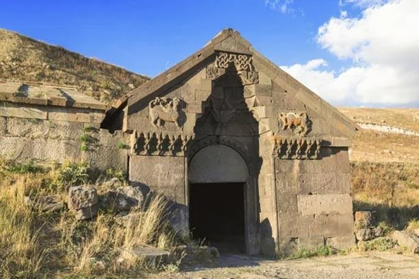
Introduction
During the Ottoman period, transportation routes connected towns, agricultural districts, mountain communities, and commercial ports throughout the Peloponnese. Travelers, merchants, officials, and military personnel depended on roads and resting places that made long journeys possible.
Caravanserais were important institutions within many Ottoman transportation networks. These establishments provided accommodation and practical facilities for merchants and travelers moving along major routes.
The possibility of Ottoman caravanserais near Kalamata Pass raises questions about the region's historical road system, trade, and movement through the mountainous interior of Messenia.
However, the existence of specific caravanserais at this location requires documentary or archaeological verification. The term caravanserai should also be used carefully because not every roadside inn or fortified building served the same function.
Ottoman Messenia
Messenia became part of the Ottoman-controlled Peloponnese during the fifteenth century, although the region experienced periods of Venetian control and changing political authority.
Kalamata developed as an important settlement within the agricultural and commercial landscape of southwestern Greece.
Its surrounding territory produced agricultural goods and supported local markets. Connections with inland communities and coastal routes allowed products to move between rural areas and larger commercial centers.
Roads through mountain passes were essential for connecting settlements separated by difficult terrain.
What Was a Caravanserai?
A caravanserai was a roadside establishment designed to accommodate travelers and commercial caravans.
In many parts of the Ottoman Empire, caravanserais provided shelter for merchants, animals, and goods. Some contained courtyards, storage spaces, stables, kitchens, wells, and sleeping areas.
Larger establishments could function as important centers of commercial activity.
Caravanserais were often supported by charitable foundations known as waqfs. Their income might come from endowed properties or other revenue sources intended to maintain the building and its services.
Not all caravanserais were identical. Their size and facilities depended on the importance of the route and the resources available to their founders.
Road Networks Around Kalamata
The region around Kalamata contains a varied landscape of coastal plains, foothills, and mountain routes.
Historically, roads connected the town with inland settlements, agricultural areas, and routes leading toward other parts of the Peloponnese.
Mountain passes were particularly important because they offered practical crossings through difficult terrain.
Travelers using these routes needed access to water, food, shelter, and places where animals could rest.
A roadside inn or fortified stopping point could therefore serve an important role even if it did not meet the full architectural definition of a caravanserai.
Trade and Commercial Activity
Messenia's agricultural economy created demand for transportation between producing communities and markets.
Products such as olive oil, grain, livestock, and other agricultural goods moved through local and regional networks.
Merchants often relied on pack animals and carts, depending on the condition of roads and the distance traveled.
A caravanserai near a major pass could provide a secure location for storing goods and arranging the next stage of a journey.
It could also encourage economic activity in nearby settlements by creating regular demand for food, animal care, repairs, and other services.
Architecture of Ottoman Roadside Facilities
Ottoman caravanserais commonly used practical architectural designs.
Many were organized around an enclosed courtyard, with rooms and service areas arranged along its perimeter.
Thick masonry walls could provide protection, while entrances were designed to control access.
Stables were especially important because animals carried much of the commercial traffic.
Some larger establishments included religious spaces, bathing facilities, kitchens, and storage rooms.
In smaller or less important locations, roadside accommodation might consist of a simpler inn or fortified building.
Identifying a Caravanserai Near a Mountain Pass
The identification of a caravanserai requires more than finding an old stone building beside a historical road.
Researchers would examine its architectural layout, access points, courtyard arrangements, storage facilities, and evidence of animal accommodation.
Historical documents could provide additional information about its original function.
Ottoman tax records, travel accounts, property documents, and waqf registers may mention roadside establishments and the people responsible for maintaining them.
Local place names and oral traditions can help guide research, but they need to be supported by independent evidence.
Security and Travel
Roadside facilities were important not only for comfort but also for security.
Travelers carrying valuable goods could face theft, difficult weather, and other dangers.
Enclosed buildings offered a degree of protection, while their location near established routes made them useful stopping points.
Some caravanserais were associated with wider administrative systems that supported travel and communication.
Their presence could reflect the importance of a road to regional commerce and government activity.
Archaeological Investigation
Archaeological research near a proposed caravanserai site would begin with historical mapping and landscape survey.
Researchers could identify surviving foundations, wall alignments, wells, water channels, and possible courtyard boundaries.
Ceramic fragments, coins, metal objects, and other materials could help establish a date range.
Geophysical survey might reveal buried architectural features without requiring immediate excavation.
A combination of architectural analysis and documentary research would be necessary to establish whether a building served as a caravanserai, an inn, a farmstead, or a defensive structure.
Conservation and Historical Significance
Surviving Ottoman roadside buildings are vulnerable to abandonment, vegetation growth, weathering, and modern construction.
Their conservation would help preserve evidence of historical transportation and commercial life.
Restoration should retain original materials and construction details wherever possible.
Interpretation could also connect the remains with wider histories of trade, travel, and the Ottoman administration of the Peloponnese.
A well-documented site could contribute to cultural tourism while helping visitors understand the importance of inland routes beyond the major coastal towns.
Conclusion
The possibility of Ottoman caravanserais near Kalamata Pass offers an opportunity to investigate the transportation and commercial networks of Ottoman-era Messenia.
Roadside establishments could have supported merchants, travelers, animals, and the movement of agricultural goods through the region's mountainous landscape.
Their architecture and documentary records could reveal how local routes connected with wider Ottoman systems of travel and trade.
Nevertheless, specific caravanserais near Kalamata Pass should not be treated as confirmed without archaeological or historical evidence. Identifying the exact route and building remains is essential to distinguishing a true caravanserai from other forms of roadside accommodation.