Introduction
Aegina occupies a strategic position in the Saronic Gulf, between the Attica peninsula and the northeastern Peloponnese. Its location made it an important point of contact between maritime communities throughout antiquity.
The title Cycladic Trade Ports Under Aegina Suburbs suggests the possibility that buried or submerged harbor facilities beneath modern settlements may preserve evidence of commercial connections between Aegina and the Cycladic islands.
Aegina's maritime and commercial importance is well established, particularly during the Archaic period. However, the existence of specific Cycladic trading ports beneath its modern suburbs requires archaeological verification.
Aegina and the Aegean Sea
Aegina's position made it a natural stopping point for vessels traveling through the Saronic Gulf.
Its proximity to Attica provided access to mainland markets, while its maritime connections extended toward the Cyclades and other Aegean islands.
The island's harbors supported fishing, transportation, and commercial activity.
Its location also made it strategically important during periods of political competition.
Aegina's Archaic Commercial Influence
During the Archaic period, Aegina became a significant commercial and maritime power.
Its merchants participated in networks extending across the Mediterranean.
Aegina is particularly associated with early coinage and commercial activity.
The island's silver coinage, including the famous turtle design, became an important feature of ancient Greek monetary history.
These developments demonstrate that Aegina was connected to broader systems of exchange.
Cycladic Trade Networks
The Cyclades contain islands with different natural resources and economic specializations.
Some communities were associated with marble, metals, agricultural products, pottery, and maritime services.
Trade between islands and mainland settlements helped circulate goods, technologies, and artistic styles.
Aegina could have participated in these networks through shipping connections and commercial partnerships.
However, evidence of trade does not automatically establish the presence of a dedicated Cycladic port district.
What Could Lie Beneath Modern Suburbs?
Ancient coastal settlements often changed substantially over time.
Harbors could become buried through sediment accumulation, shoreline movement, construction, or changes in sea level.
Modern buildings and roads may cover archaeological deposits.
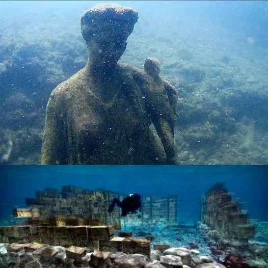
In some locations, ancient waterfront structures may survive beneath later urban development.
Potential remains could include quays, warehouses, paved surfaces, mooring installations, and harbor-related buildings.
Archaeological Methods
Investigating buried harbor structures requires a combination of land-based and underwater methods.
Ground-penetrating radar and electrical resistivity surveys may help identify buried walls and other features.
Underwater surveys can examine submerged structures and ancient shoreline deposits.
Sediment cores may help reconstruct changes in coastal geography.
Excavation and material analysis are necessary to determine the date and function of identified structures.
Identifying Cycladic Connections
Imported pottery is one of the most useful forms of evidence for ancient trade.
Ceramic fabrics, decorative styles, and manufacturing techniques can sometimes identify an object's likely production region.
Other evidence may include stone materials, metal objects, inscriptions, and shipwreck cargoes.
However, an imported object does not prove that merchants from its place of origin operated a permanent trading station.
It demonstrates contact or exchange, which may have occurred through several intermediaries.
Ancient Harbors and Changing Coastlines
Coastal environments are dynamic.
Sediment carried by currents and rivers can gradually alter harbor conditions.
Earthquakes and tectonic movement may also affect relative sea levels and coastal structures.
A harbor that was useful in antiquity may eventually become too shallow, exposed, or inaccessible for maritime activity.
These processes can make ancient harbor remains difficult to recognize in the modern landscape.
Conservation and Urban Development
Aegina's modern settlement creates challenges for archaeological investigation.
Construction, road improvements, utility installation, and coastal development can disturb buried remains.
Archaeological monitoring is important when major groundworks take place in historically sensitive areas.
Digital mapping can help preserve information about structures that cannot be excavated or exposed.
Conclusion
Cycladic Trade Ports Under Aegina Suburbs provide an opportunity to investigate the relationship between ancient maritime commerce and the changing geography of the Saronic Gulf.
Aegina's commercial significance and its connections with the wider Aegean are historically established.
The existence of particular buried Cycladic port facilities beneath modern suburbs, however, requires direct evidence.
If such remains were identified, they could help clarify how Aegina's harbors developed and how the island participated in the commercial networks linking mainland Greece with the Cyclades.