Introduction
The Evros River forms much of the land border between Greece and Turkey in northeastern Greece. Because of its geographical position, the region has become a major focus of European border-management policy, migration monitoring, and security operations.
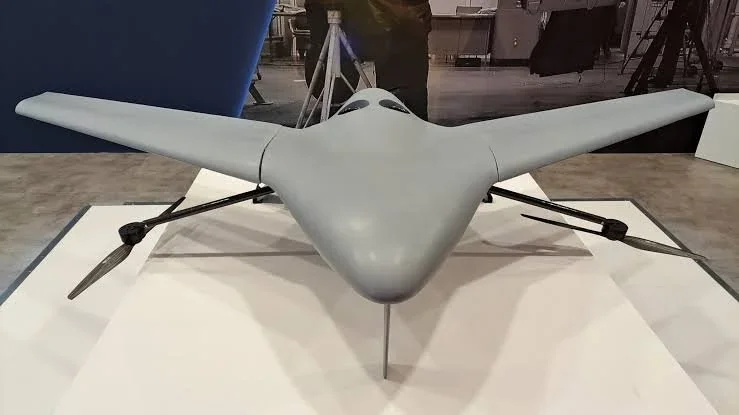
The title Drone Surveillance Along Evros Border Fence examines the use of unmanned aerial vehicles to observe border areas and support surveillance activities.
Drone technology is already used in many border-monitoring contexts around the world. However, the specific equipment, deployment patterns, and operational capabilities used along the Evros border can change over time and should not be assumed without reliable documentation.
The Geography of Evros
The Evros region contains river channels, agricultural land, wetlands, settlements, and areas of difficult terrain.
The river itself forms a natural boundary along much of the frontier.
Seasonal flooding and changes in water levels can influence access and movement.
These geographical conditions make border monitoring technically challenging.
The Border Fence
Greece has constructed and expanded physical barriers along sections of its land border with Turkey.
These barriers are intended to support border control and prevent unauthorized crossings.
The fence is part of a broader system involving patrols, observation equipment, border personnel, and cooperation with European institutions.
It does not eliminate the need to monitor areas where terrain or river conditions create additional challenges.
How Drones Support Surveillance
Unmanned aerial vehicles can provide aerial observation without requiring a crewed aircraft to remain continuously in the air.
Depending on the platform, drones may carry optical cameras, thermal sensors, or other monitoring equipment.
They can help operators observe difficult terrain, assess environmental conditions, and direct ground personnel toward areas requiring attention.
Their usefulness depends on weather, battery endurance, communication systems, and operational restrictions.
Thermal Imaging and Night Monitoring
Thermal cameras detect differences in heat radiation.
They can help identify people, vehicles, or other heat-producing objects under certain environmental conditions.
However, thermal imagery does not automatically reveal identity or intent.
Vegetation, buildings, weather, distance, and sensor quality can all affect performance.
Thermal monitoring should therefore be understood as an observation tool rather than a complete identification system.
Integration with Ground Systems
Drone surveillance can be integrated with other monitoring technologies.
These may include fixed cameras, ground sensors, radar, communication networks, and patrol systems.
When properly coordinated, aerial observation can help personnel understand a situation before deploying ground resources.
The quality of this coordination depends on reliable communications, trained operators, and clear procedures.
Humanitarian and Legal Considerations
Border surveillance raises important questions about human rights and the treatment of people attempting to cross borders.
People detected near a border may include asylum seekers, refugees, migrants, local residents, and individuals in distress.
Surveillance systems must operate within applicable legal frameworks.
Monitoring should not replace humanitarian assistance, rescue operations, or individual assessment of protection needs.
Privacy and Accountability
Aerial surveillance can collect information about people who are not suspected of wrongdoing.
This creates privacy concerns, particularly when imagery is stored or shared.
Responsible systems require clear rules governing data collection, access, retention, and deletion.
Independent oversight and transparent procedures can help ensure that surveillance remains proportionate and accountable.
Environmental and Operational Limits
The Evros landscape includes ecologically sensitive areas, including wetlands and habitats supporting migratory birds.
Drone operations can create disturbances if conducted without appropriate environmental consideration.
Weather, wind, rain, and communication limitations can also reduce operational reliability.
Technology must therefore be used with an understanding of the local environment.
Conclusion
Drone Surveillance Along Evros Border Fence illustrates how unmanned aerial technology is becoming part of modern border-management systems.
Drones can improve observation and situational awareness, particularly in areas that are difficult to monitor from the ground.
However, their use must be balanced with privacy protections, humanitarian responsibilities, environmental safeguards, and legal accountability.
The effectiveness of border technology should not be measured only by how much territory it can observe, but also by whether it supports lawful, proportionate, and humane border management.