Introduction
The Evros, known as the Maritsa in some neighboring languages, forms a major river system in southeastern Europe. Its lower reaches create a broad delta near the Aegean Sea, where freshwater, seawater, wetlands, agricultural land, and coastal habitats interact.
The Evros Delta is particularly important for biodiversity and migratory birds. Its landscape includes channels, lagoons, marshes, floodplains, and shifting sediment deposits.
The idea of subterranean rivers flowing through caverns beneath the delta raises questions about groundwater movement and the geological processes that shape low-lying coastal environments. However, the presence of a major river delta does not establish the existence of an extensive underground river-and-cavern system. That possibility would require geological and hydrological investigation.
The Formation of a River Delta
A delta develops when a river deposits sediment as it enters a standing body of water, such as a sea or lake. The reduction in current speed allows sand, silt, clay, and organic material to accumulate.
Over time, sediment builds new land and alters the river's channels. Floods, storms, tides, and changes in sea level can reshape the delta.
The Evros Delta is therefore a dynamic environment. Its channels and wetlands reflect the continuing interaction between river flow, sediment transport, and coastal processes.
Understanding Subterranean Rivers
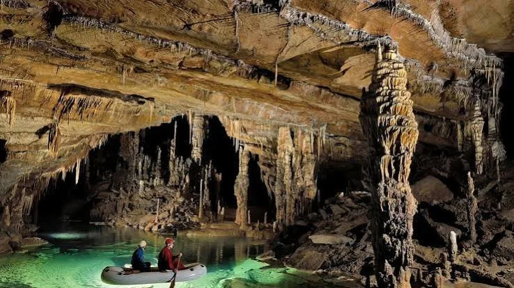
A subterranean river is a stream or body of flowing water that travels underground through natural openings, fractures, or caves.
Such systems are particularly associated with karst landscapes, where soluble rocks such as limestone dissolve over time and develop underground drainage networks.
Water can enter these systems through sinkholes, fractures, and permeable ground, then emerge at springs or other outlets.
However, not all underground water forms a cave river. Groundwater may move slowly through sediment pores or rock fractures without creating a large open passage.
The Geological Conditions of the Evros Delta
River deltas commonly contain layers of sand, silt, clay, and organic deposits. Groundwater can move through permeable layers, while less permeable sediments restrict or redirect its flow.
This can create complex underground water systems without requiring large caves.
The existence of subterranean caverns depends on local geology. Limestone or other soluble rock formations may support cave development, but their presence and depth must be established through geological mapping.
A claim about a cavern beneath the Evros Delta therefore requires evidence that the underlying rock and sediment structure could support such a feature.
Groundwater and Wetland Ecology
Groundwater contributes to the functioning of many wetlands. It may sustain springs, influence soil moisture, and help maintain water levels during periods of limited rainfall.
In delta environments, groundwater can interact with river water and seawater. This interaction can affect salinity, vegetation, and the distribution of aquatic habitats.
Groundwater is also important for human activities, including agriculture and drinking-water supply.
Understanding its movement helps scientists assess the effects of water extraction, pollution, drought, and changes in river flow.
Methods for Investigating Underground Water
Hydrologists and geologists use several methods to study groundwater and possible underground channels.
These may include borehole records, electrical resistivity surveys, seismic methods, groundwater-level measurements, and chemical analysis of water samples.
Ground-penetrating radar can be useful in some settings, although its effectiveness depends on sediment composition, moisture, depth, and other conditions.
Dye tracing may help identify connections between a known water input and an outlet, but it must be designed carefully to avoid harming the ecosystem.
No single method automatically proves the presence of a cavern. Findings must be interpreted together.
The Difference Between Caves and Aquifers
A cave is an open underground space large enough for people or equipment to enter, depending on its dimensions. An aquifer is a geological formation capable of storing and transmitting groundwater.
An aquifer may contain enormous quantities of water without containing a visible cave. Conversely, a cave can carry water but may not function as a major regional aquifer.
This distinction is especially important when describing underground features in a sediment-rich delta.
Ecological Sensitivity
The Evros Delta is an important wetland landscape, and changes to groundwater conditions can affect plants, fish, invertebrates, birds, and surrounding communities.
Excessive groundwater extraction can lower water tables. Pollution can move through underground systems and reach wetlands or coastal waters.
Scientific exploration must therefore account for environmental protection as well as geological curiosity.
Conclusion
Subterranean rivers beneath the Evros Delta are an intriguing geological possibility, but an extensive cavern system should not be presented as a confirmed feature without supporting evidence. The delta's groundwater dynamics are important regardless of whether large underground caves exist. Geological mapping, hydrological measurements, and careful environmental monitoring can reveal how water moves beneath the wetlands and how these hidden processes influence one of southeastern Europe's important coastal ecosystems.